VIRGINIA GORDON
Communications Coordinator
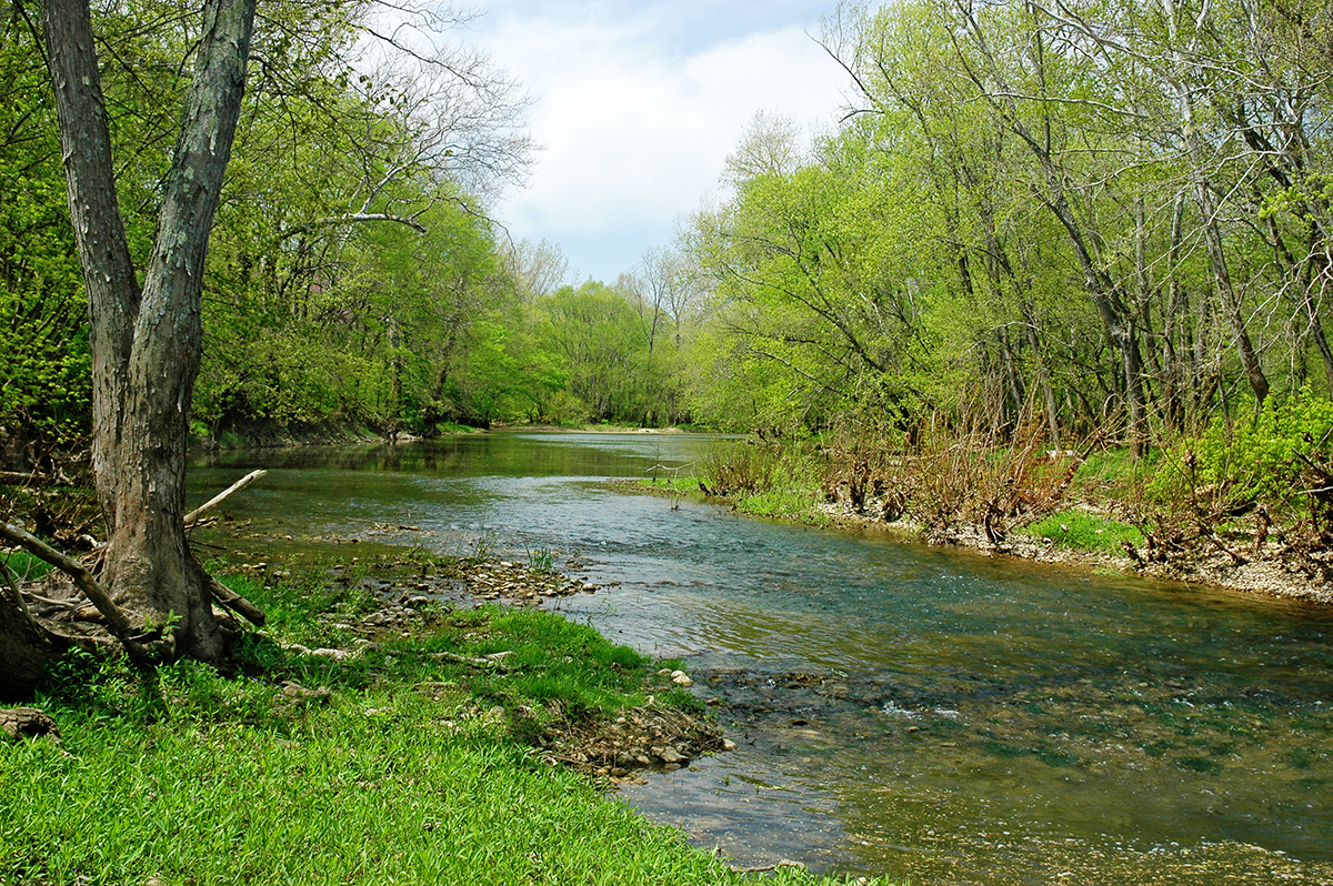
At a little more than 7,000 acres in area, Battelle Darby Creek Metro Park is by far the largest of the parks in the Columbus and Franklin County Metropolitan Park District. It is well known for its bison herd, the prairies, and the Big Darby and Little Darby creeks. Indeed, it’s because of these creeks, and the need to protect the Darby Creek Watershed, one of central Ohio’s premier but most fragile natural resources, that the park has grown so large. Both creeks are designated as state and national scenic rivers, and in 1991 The Nature Conservancy declared the Darby Creeks and their 560-square-mile watershed to be one of the 12 Last Great Places of the Western Hemisphere in need of saving.
The founders of Metro Parks were aware of the need to protect the creeks much earlier than that. In 1945, in the report that inspired the creation of the Columbus and Franklin County Metropolitan Park District, the Big Darby and Little Darby creeks were identified as one of the prime areas of interest for conservation in a potential future Metro Parks system. Compiled by a committee of the Wheaton Club, and under a section heading for Big and Little Darby Creeks, the report declared that:
“Some of the finest wild land in the county lies along the valleys of these streams, particularly along Big Darby for three or four miles south from the West Broad Street bridge. Prairie conditions and alkaline soil types present would give a variety of habitats and conditions not to be found in the eastern half of the county.”
As early as March 1950, Metro Parks managed to acquire its first parcel of land in that “sweet spot” identified in the Wheaton Club report. This 34-acre area was just north of Alkire Road on the east side of Big Darby Creek. Another 77 acres, immediately north of the first land purchase, was acquired in June 1958. The following year, this combined area was opened to the public as Darby Creek Metro Park, the third park in the Columbus & Franklin County Metro Park system. (Blacklick Woods Metro Park had opened in October 1948, and Blendon Woods Metro Park had opened in 1951.) In 1962, an 8.5-acre area immediately north of the existing park was acquired by Metro Parks, which included one of only two then-known remnant prairies from the original Darby Plains prairies. In its first decade, more than one and a quarter million visitors came to the now 119-acre park in western Franklin County.
THE RESERVOIR THAT NEVER WAS
In the early 1960s, the US Army Corps of Engineers was authorized to construct a dam on Big Darby Creek, which would have resulted in a Darby Creek Reservoir. It was expected that the reservoir would have a permanent pool of water covering 676 acres, with the purpose to provide flood control in the Big Darby Creek Watershed, the Scioto River Basin, and the Ohio River Valley. As part of the project, the Army Corps of Engineers acquired 834 acres of land along Big Darby Creek, west of the village of Darbydale. The dam itself was projected to be located close to State Route 665.
Potential problems arose when the Corps made test borings on site in 1964 and discovered a deep underground hole. There were fears the dam’s proposed concrete spillway might be too heavy for the site and might slide down the hole.
A re-design of the project was called for, and pollution control and recreation were added to the purpose of the reservoir. Metro Parks submitted a proposal to the Corps of Engineers in October 1965, advocating that Metro Parks itself should become the developer of the resulting reservoir site as a public park. This view was seconded by the Ohio Department of Natural Resources (ODNR) and led to the development of a detailed preliminary design study by Metro Parks, ODNR and the Huntington (West Virginia) District Corps of Army Engineers.
More problems were encountered as the project progressed, with construction delays, rising costs, public opposition from local property owners and calls from local environmental groups for the project to be deauthorized by the US Congress. The project was put on hold for several years and finally abandoned in 1978 when the Army Corps of Engineers agreed that the project should be deauthorized by Congress. In the intervening years, ODNR’s Division of Wildlife had leased the 834 acres of land owned by the Army Corps of Engineers and used it for public hunting. Four years later, the US General Services Administration notified the Governor of Ohio that the 834 acres held by the Corps of Army Engineers was to be declared surplus US Government property. ODNR’s Division of Wildlife had hoped that the land might be gifted to them, but it was put up for public sale. Metro Parks acquired the property in 1984 and added it to what had by then become Battelle Darby Creek Metro Park. This 834-acre area is still used for public hunting in the fall and winter hunting season, and is clearly marked on maps of the park.
PROTECTING THE CREEKS
By September 1976, Darby Creek Metro Park stood at 397 acres, with the land concentrated north of Alkire Road, where Little Darby Creek flows into Big Darby Creek. In that same month, Metro Parks, recognizing the expanding threat to the creeks from future housing developments, wrote to the Board of Trustees of the Battelle Memorial Institute Foundation with an extraordinary proposal.
The letter requested that the Institute should offer a grant of $1,850,000 over a 4-year period, to help cover the cost of acquiring 2,440 acres of land between Georgesville and State Route 665. And in return, Metro Parks proposed that this new land should become known as Battelle Metropolitan Park. The need for the project was highlighted in stark terms in Metro Parks’ letter:
“The proposed Battelle Metropolitan Park comprises one of the last sizable undeveloped natural areas in Franklin County. Big Darby Creek is listed by the Ohio Department of Natural Resources as a State Scenic River and is the last free-flowing relatively unspoiled major stream in Franklin County. If the proposed project area is not acquired at this time for public outdoor recreation it will be lost to private development.”
In response, the Battelle Memorial Institute Foundation offered a grant of one million dollars to Metro Parks for the project. Metro Parks was able to secure matched funding from the US Department of the Interior’s Heritage Conservation and Recreation Service. The initial proposal estimated that land acquisition of the identified 2,440 acres would amount to $3,700,000. More funds were secured from the US Federal Bureau of Outdoor Recreation. It took more than six years to acquire the land, as Metro Parks had to follow strict acquisition guidelines provided by both the state and federal governments, with all parcels of land being fully appraised by Metro Parks and then approved by the state’s real estate section of the Department of Natural Resources. In accordance with the initial proposal, Metro Parks added the new acquisitions to the existing 397-acre park, which then became known as Battelle Darby Creek Metro Park.
THE DARBY PLAINS
As indicated in the 1945 report, the Big Darby Creek and Little Darby Creek land that interested Metro Parks provided good soil conditions for prairies. The land sits in the historic Darby Plains, a vast area of prairies and meadows in the time before European settlement. These prairies disappeared as settlers began the long transformation of land use to pasture and agriculture. By the early 1960s, as indicated in “Prairies of the Darby Plains in West-Central Ohio*,” only two remnant prairies (original prairies undisturbed by settlers) were known to exist in the entire Darby Plains area. One of these was the Bigelow Pioneer Cemetery in Pike Township in northern Madison County, and the other was the Bluff Prairie, which Metro Parks acquired and added to Darby Creek Metro Park in October 1962.
*[Prairies of the Darby Plains in West-Central Ohio (an essay by Charles C. King), hereafter called “Darby Plains, King,” was included in materials presented for the 6th North American Prairie Conference, held in Columbus in August 1978, and published in 1981. It’s of note that, as Metro Parks acquired more land for Battelle Darby Creek Metro Park, more original Darby Plains remnant prairies were found on park land. These include small prairie remnants either side of Graessle Road and south of US 665, in the land formerly owned by the US Corps of Engineers and acquired by Metro Parks in 1984.]
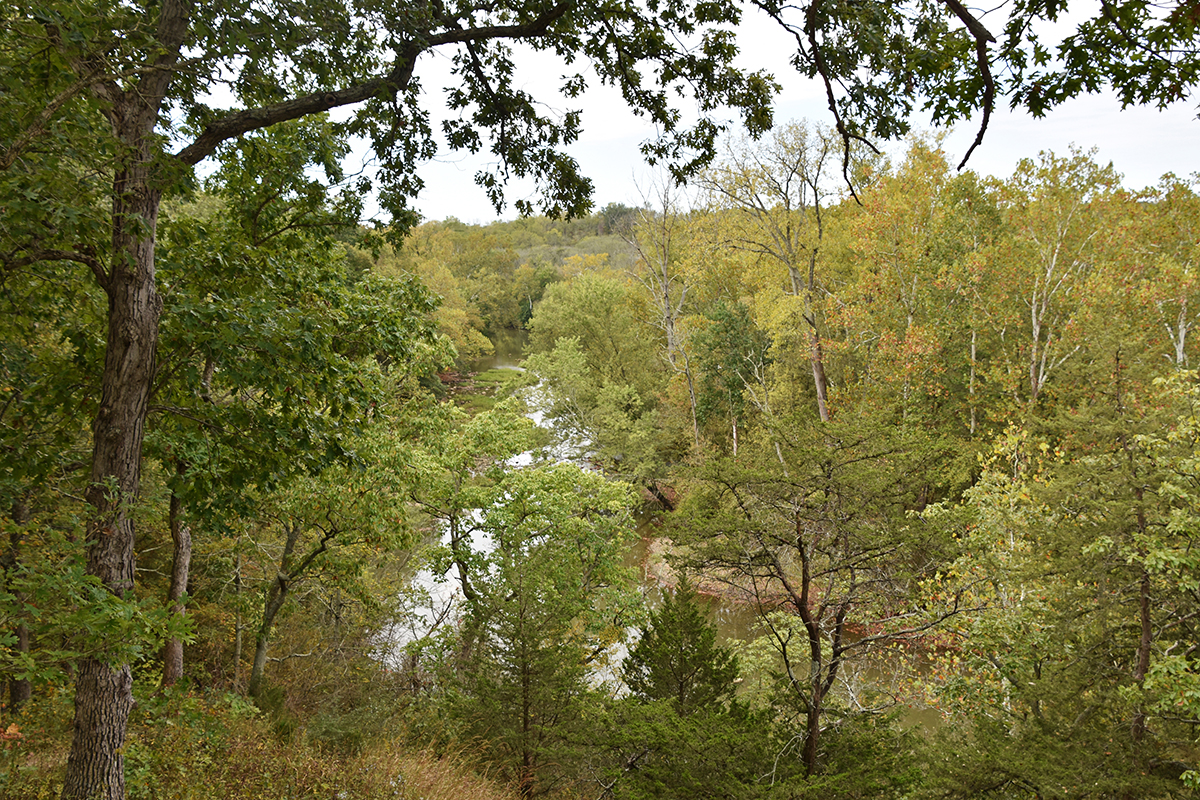
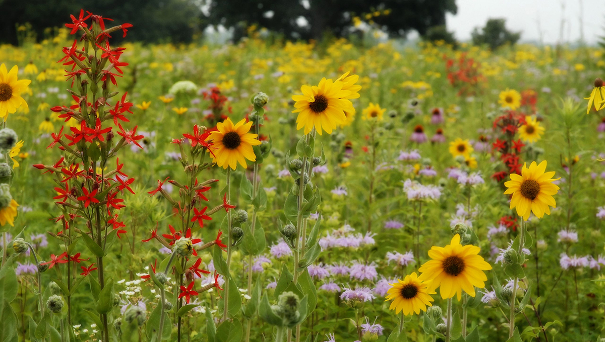
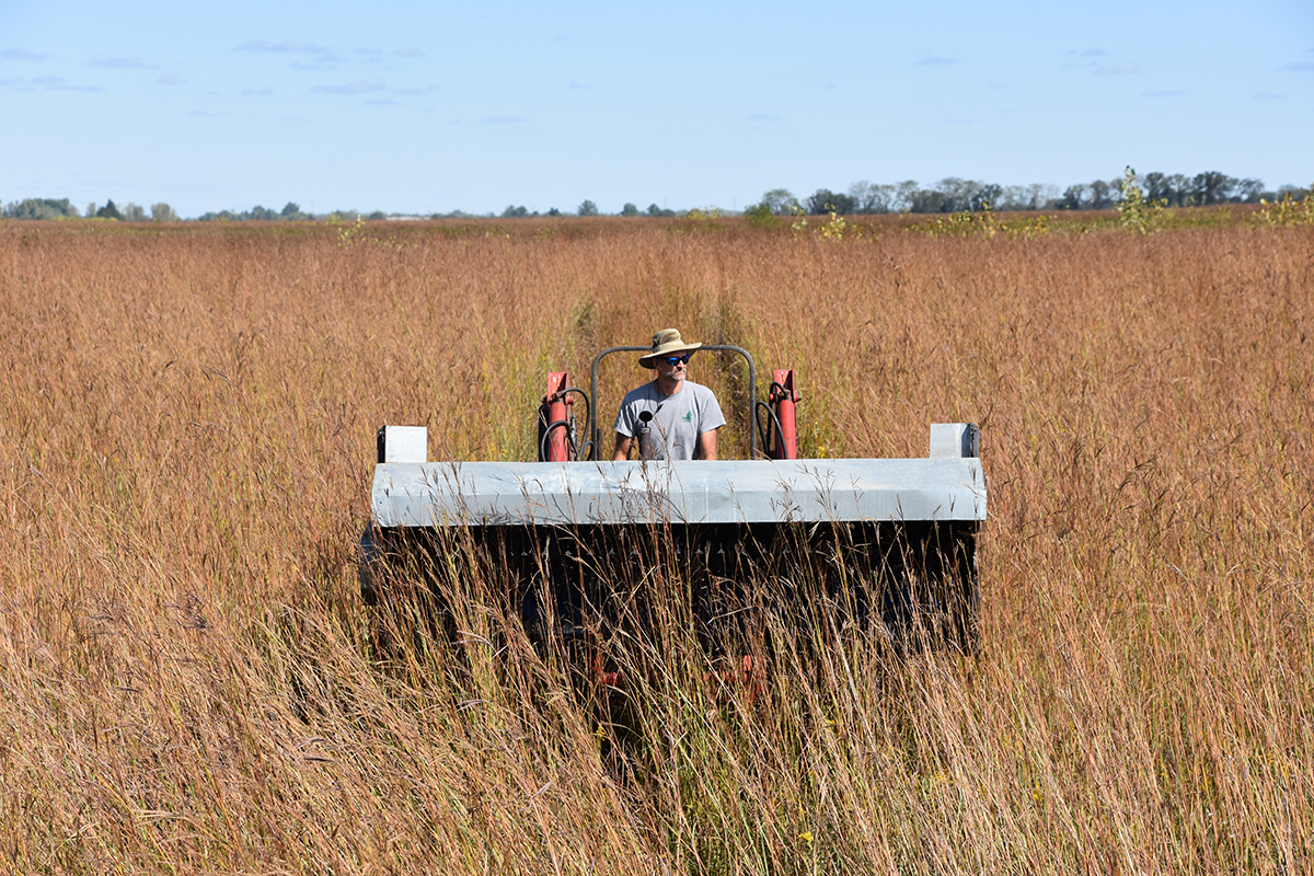
The 4-acre Bluff Prairie included 50 species of prairie plants on an eroded hillside on the east bank of Big Darby Creek. It can be seen from the Overlook Deck behind the Cedar Ridge Lodge. Protecting this prairie remnant, and restoring long-gone prairie habitats, was a key goal for Metro Parks’ resource managers. Led by its own prairie specialist, Jack McDowell, Metro Parks created a first reconstructed prairie in 1974, near the old day camp off Gardner Road, and added a 12.5-acre prairie, later expanded to 47.5 acres, west of Big Darby Creek. This prairie is bisected by the Wagtail Trail. The 50-acre Indian Ridge Prairie was begun in the late 1980s and completed after several years of effort. These latter prairies were propagated entirely by seeds from remnant Darby Plains prairies or other scattered sources of original Darby Plains seeds. These scattered sources included roadways and railways, as well as undisturbed fields that had never been plowed, mowed or grazed. In time, our restored prairies themselves became the source of native seeds of Darby Plains grasses and forbs. Seeds of prairie flowers are collected by hand, with each species kept separate. For prairie grasses, Metro Parks now uses seed stripper machinery to collect seeds in bulk.
FIRES ON THE PRAIRIE
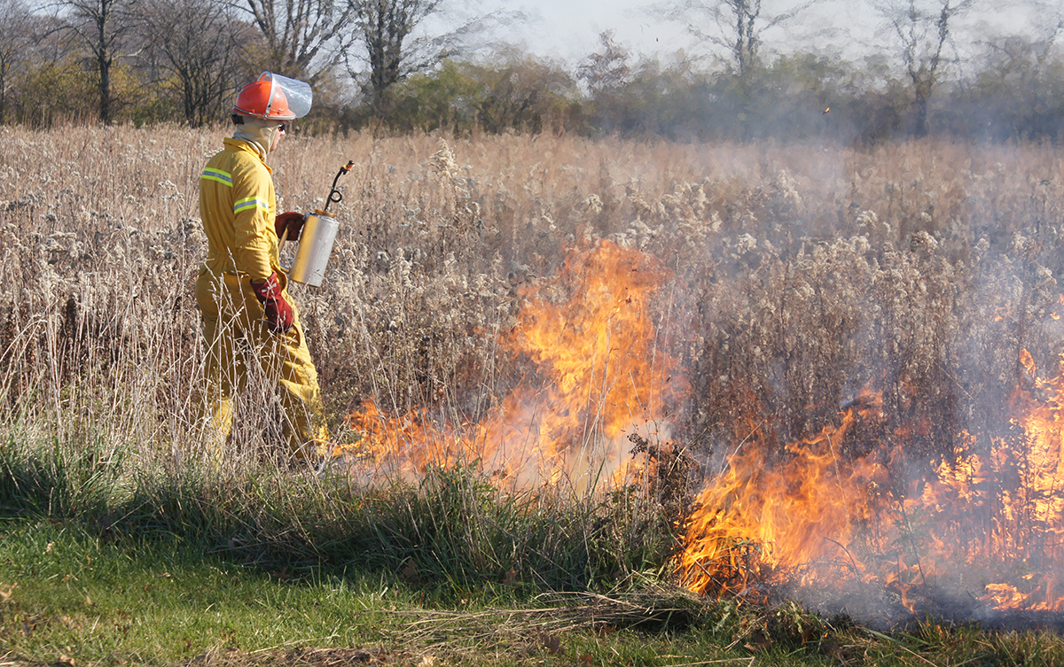
For centuries prior to European settlement, Native Americans would deliberately set controlled fires to manage woodland and prairie areas and to aid their hunting. Metro Parks uses similar techniques today to manage its prairies. Prescribed burns, carefully controlled by experts, are performed in late-winter, before leafout, or late in the fall. They help to enrich the soil and clear the land of invasive plants, affording native plants the best opportunity to thrive. Natural fires were also a feature of the prairies. The tall grass prairies of the pre-settlement Darby Plains grew six to 8-feet-high and included masses of colorful wildflowers. In certain parts, these prairie areas included groves of burr oaks and hickories, known now as oak savannas. Large areas of the Darby Plains prairies were covered by water for several months of the year but would become very dry through summer and fall. This was especially so after settlers began to drain the prairies. Lightning strikes could set the dry prairie grasses alight and lead to spectacular fires that threatened the homesteads of early settlers.
WET PRAIRIES
The first settlers considered the wet prairies of the Darby Plains as unfit for agriculture and referred to them as the “barrens.” The land was used initially for pasture. In time, ditching and tiling transformed the inhospitable wet prairie to valuable agricultural land.
By the start of the 21st century, Metro Parks had restored about 400 acres of prairie at Battelle Darby Creek Metro Park. All of the reconstructed prairies to that date were created on land that had been farmed or used for pasture, and which still included drainage tiles. A far larger project, to create wet prairies of the type widely known in the Darby Plains before European settlement was begun in the early 2000s.
THE WATTS WETLAND
Named after former Metro Parks Resource Manager, John Watts, the Watts Wetland is a 700-acre wet prairie built on land acquired from the old Darby Dan Farm, owned by the Galbreath family. The land purchase itself is of note for being the largest transaction of land ownership from a single source in the Metro Parks system, totaling 1,300 acres. The sale was finalized in 2004 and includes land both west and east of Darby Creek Drive. The Watts Wetland is on the east side of Darby Creek Drive, and south of Kuhlwein Road.
Originally known as the Kuhlwein Road Wet Prairie, this became Metro Parks’ largest restoration project. By removing subsurface drainage tiles and restoring the land to its natural hydrology, Metro Parks effectively improved the quality of the Darby Creek Watershed.
It had long been recognized that one of the greatest threats to the health of the creeks was sedimentation from the runoff of agricultural topsoil after heavy rains. The wet prairie wetland cells alleviate that problem. They hold water for longer periods, capture sediments polluted by agricultural chemicals, and allow filtered surface water to enter the groundwater table over time, rather than draining directly into Big Darby Creek over a matter of a few days, via a drainage tile system.
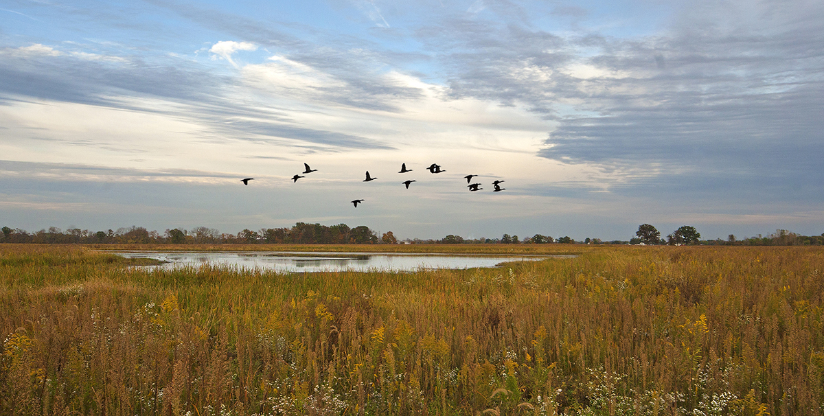
Restoration work for the wet prairie was completed in late 2010. In the 12 years since then, the site has been allowed to progress naturally, with occasional resource management interventions. It has become a premier site for migrating wetland and grassland bird species. The Watts Wetland includes 20 wetland cells of different sizes and is planted with native seeds of Darby Plains prairie grasses and forbs, picked from the park’s restored prairies. Sandhill cranes are seen frequently at the wetlands.
OTHER WETLAND RESTORATION PROJECTS
On Metro Parks’ land north of Kuhlwein Road, but east of Darby Creek Drive, a 120-acre swamp forest was built as a wetlands mitigation bank just a couple of years later, by the Stream and Wetlands Foundation. They planted thousands of seedling oaks, mostly swamp, white and pin oaks, which are growing well with many of them now between 10 and 20 feet high. Metro Parks also restored a swamp forest of about 400 acres on the old Darby Dan Farm land west of Darby Creek Drive, utilizing grants from the Ohio Environmental Protection Agency’s WRRSP (Water Resource Restoration Sponsorship Program), which funds water quality improvement projects. These wetland restorations played an important role in our continuing efforts to protect the Darby Watershed and its two creeks.
WHERE THE BUFFALO ROAM
Bison (or buffalo, as they were commonly but incorrectly called in the pre-settlement and early settlement years of Ohio), were a feature of the great plains of North America, and common in the Darby Plains too. In 1759, James Smith reported in his journal that he had shot a “buffalo” on a winter hunting trip to the Darby Plains. As quoted by Charles King in his Darby Plains article, Smith also wrote that: “A considerable way up Ollentangy [Big Darby Creek] on the southwest side thereof, or betwixt it and the Miami, there is a very large prairie.”
Note, in the early days of European settlement, the Big Darby Creek was called (as Smith calls it) the Ollentangy. What is known to us now as the Olentangy River was in those days known as the Whetstone River. Smith, who later became a Colonel in the US Army, was captured by Native Americans in 1755, when he was 18 years old, and brought from Pennsylvania to the Ohio lands. He was adopted into a Native American family but escaped in 1759. It was not until 1833 that the Ohio General Assembly formally declared the names of our local rivers to be as we know them today. The word “Darby” comes from the Anglicized name of a Native American chieftain who lived along the creek.
THE RETURN OF THE BISON
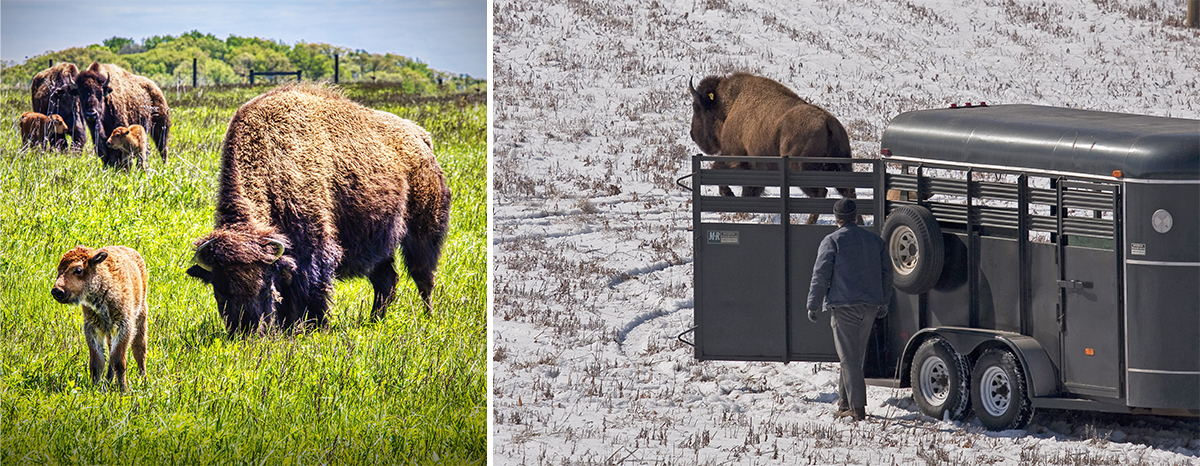
As well as planning to restore native prairies to central Ohio, Jack McDowell and other Metro Parks resource managers were keen to return bison to the prairies too. For a number of years, Metro Parks had helped The Wilds to create the right prairie habitats for their own herds of bison. That relationship eventually led to discussion about bison coming to the prairies at Battelle Darby Creek Metro Park. Almost a decade went by from first discussions to the reality of these magnificent mammals patrolling their own enclosures in a Metro Parks prairie. Six female bison arrived from The Wilds in February 2011 and quickly made a home in their two prairie enclosures.
A nature center was built at Battelle Darby Creek Metro Park and opened in October 2012. A good view of the bison can be seen from a balcony outside the nature center, overlooking the bisons’ 40-acre winter enclosure of cool season pasture grasses. In summer the bison are moved to a separate 30-acre prairie planted with native Darby Plains grasses and forbs. The Darby Creek Greenway Trail affords good views of the bison in their summer pasture.
The herd has grown twice since their arrival, after a bull was introduced to the female-only herds in 2014 and another bull joined the herd for a time in 2021. Currently there are 11 female bison to be seen at the park’s bison enclosures.
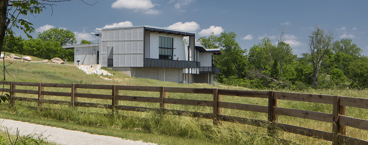
By 1994, when the Everett H Krueger Nature Center was opened at Highbanks, Metro Parks had three nature centers, providing resources and educational facilities for visitors. The first two Metro Parks, Blacklick Woods and Blendon Woods also had nature centers. Metro Parks was keen to add a nature center at the largest Metro Park and made a commitment to it in its levy promises to voters in 2009.
Thanks to the passage of the levy by Franklin County voters, the 14,000-square-foot Battelle Darby Creek Nature Center opened its doors in October 2012 and it included a number of innovative features. The building itself is built into a hillside, and has a vegetated roof, planted with nodding wild onion, various varieties of creeping phlox and woodland stonecrop. The design reduces its visual impact so that visitors, as they approach the nature center, see nature rather than architecture.
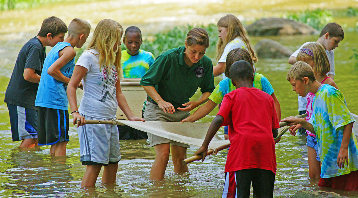
The centerpiece of the interior is a 53-foot living stream, filled with fish, mussels, turtles, amphibians and plants native to the Darby Creek Watershed. The nature center also includes two meeting rooms and a wide range of interactive exhibits that help visitors to engage with both the natural and cultural history of the park.
THE FAMOUS RACING BARN
Reference was made earlier to the acquisition of land formerly part of Darby Dan Farm. Part of that land, west of Darby Creek Drive and reaching up to a northern boundary of US 40, includes an old racing barn, complete with a 1-furlong indoor oval track (1 furlong = one-eighth of a mile), a grandstand, and a 1-mile outdoor oval. Metro Parks has restored the outdoor oval as part of the Darby Creek Greenway Trail. Nine furlong markers along the 1-mile loop have also been restored.
John Galbreath named his property Darby Dan Farm after its namesake in Kentucky, which he also owned. He trained many famous racehorses in both locations, including the Kentucky Derby winner, Chateaugay, and the Epsom Derby (England) winner, Roberto. President Gerald Ford and Princess Margaret (sister of Queen Elizabeth II) visited Galbreath at his Ohio Darby Dan Farm and watched horses train from the grandstand.
FACILITIES AND ACTIVITIES TODAY
There are more than 20 miles of trails in Battelle Darby Creek Metro Park, running alongside the creeks, or passing through woods, prairies and wetland areas. Almost all of the trails have a natural surface, either grass or dirt and gravel, and all are great for hiking. A few of the trails allow leashed pets. The Darby Creek Greenway Trail is also great for biking, as is the sole paved trail in the park, a section of the longer Camp Chase Trail, which itself is part of the much longer Ohio to Erie Trail.
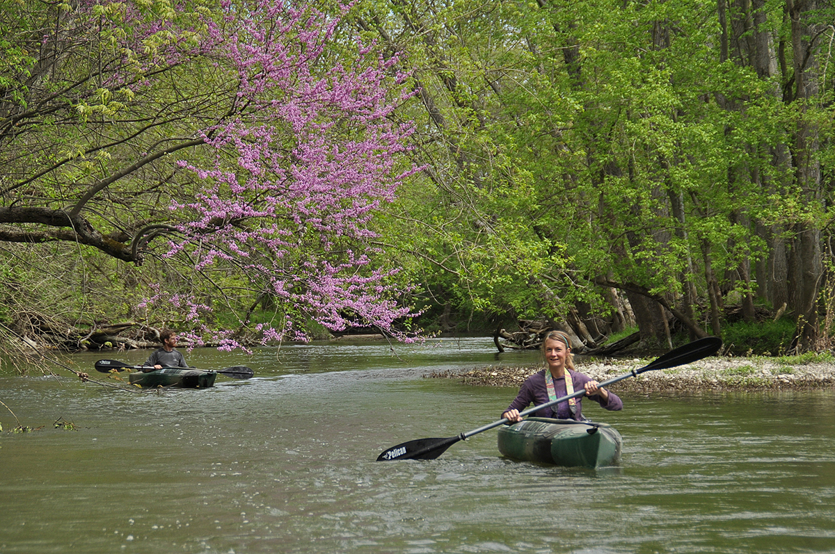
Recreational water activities include fishing from access points on the two creeks, and also at the 14-acre Osprey Lake and in lakes at the Pleasant Valley Area. Both of these latter areas include pet trails and places for dogs to swim. There are two access points to the creeks for canoers and kayakers. Winter sports enthusiasts have a sledding hill and an ice skating pond to use when weather conditions allow, and the Dyer Mill Trail is reserved exclusively for cross-country skiing when there is enough snow.
There are two outdoor reservable shelters, each accommodating up to 80 people, and the Cedar Ridge Lodge, holding 72 people, is also available to reserve for special occasions and events. The park also includes numerous first-come first-serve picnic shelters with tables and grills.
THE FUTURE
As central Ohio continues to develop and its population and industries expand, pressure on the natural environment will inevitably expand with it. Protecting a natural resource as valuable as the Darby Creeks means there can be no let up. The Nature Conservancy has acquired land in the headwater sector of Big Darby Creek and in 2007 began a 4-year project to restore the headwaters. The project reversed channel modifications made to aid farm drainage and highway construction. This area is now part of the 1,000-acre Big Darby Creek Headwaters Nature Preserve. This, along with Battelle Darby Creek Metro Park and Prairie Oaks Metro Park, are the only sizeable publicly-owned sections of the 84-mile stretch of Big Darby Creek.
When The Nature Conservancy included Big Darby Creek as one of its Last Great Places, it declared the Darby Creek Watershed to be “the healthiest and most diverse aquatic system of its size in the Midwest and… among the top five warm freshwater habitats in the nation.”
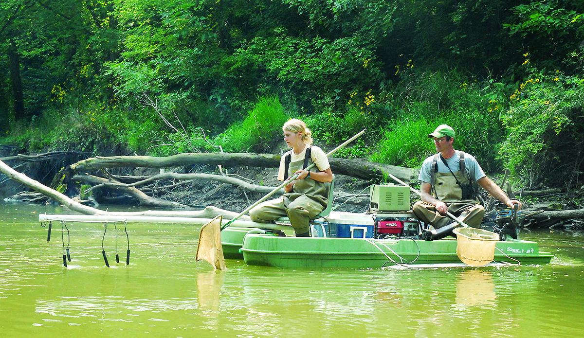
Major studies of the creeks have continued over the years, conducted by Ohio State University, The Nature Conservancy, and the US Environmental Protection Agency. In the 1990s, these studies confirmed both the health and the fragility of the creeks. More than 100 species of fish and 44 species of mollusks were recorded as breeding in the creeks.
More recent surveys have shown that water quality in Big Darby Creek, as measured by chemical and bacterial analysis, is holding steady and is registered as “fair” to “good.” However, there are worrying signs that this steady quality is not reflected in the aquatic life of the creek. Mussels, whose presence in the creeks is a prime indicator of overall water quality, are beginning to decline. Some important indicator species, such as the northern riffleshell, were not located during the latest surveys. As yet, there are no known reasons to account for the decline. And plenty of reasons to be concerned.
Chemical leaks, industrial waste and agricultural runoff are ever-present threats. Developments anywhere within the 560-mile watershed, even if many miles away from the creeks, can lead to sedimentation and pollution of the creeks. Organizations such as Metro Parks, The Nature Conservancy, The Darby Creek Association, and various governmental branches and departments, continue the fight to protect this “Last Great Place.”
This article was very interesting and informative. Thank you all at the metro park’s for doing your part to save our planet.
THANKS TO OUR METRO PARKS BEING KEY PARTNERS IN The visionary RAPID5 PLAN 5
Love the article. My grandfather was raised on a farm that was later to become Darby Dan Farm. The farmhouse is still there and visible from Darby Creek road. He used to talk about fishing in Darby creek. Most of the family that knew of the history of the farm are gone, and as is the case, that part of our past is also gone. I don’t know if in your records there is any information about the Grener family and their time on that land. It would have been in the mid 1800’s to the early 1900’s. Grandpa went to OSU and worked in the dairy barns. He became a vo-ag teacher where he met my grandmother. I’m not sure when the farm was sold and who it was sold to.
Hello Doreen – I’m glad you liked the article. I’m afraid I haven’t seen any references to the Grener family in the research I did for this article. You might chose to reach out to the Ohio Historical Society, to ask if they can point you in the right direction to find out if there is information available in their own or other known sources.
What a great article! Thank you.