VIRGINIA GORDON
Communications Coordinator
In this month’s 20 IN 22 journey through the parks and their history we encounter the shale banks of Highbanks Metro Park and the spruce and pines of Walnut Woods Metro Park.
HIGHBANKS METRO PARK
Although it wouldn’t open as a Metro Park until 1973, the land that became Highbanks Metro Park had long been identified as a prime site for a future park. The 1945 report proposing a Metropolitan Park System for Franklin County, and which led to the establishment of the Columbus and Franklin County Metropolitan Park District (see 20 IN 22: A Multigenerational Celebration of Metro Parks), recognized Flint Ravine and High Banks as one of nine areas suitable for acquisition, conservation and development as a park.
In Part III of the report, subtitled “Special Franklin County Areas Suitable for Consideration in a Metropolitan Park Program”, the Committee wrote:
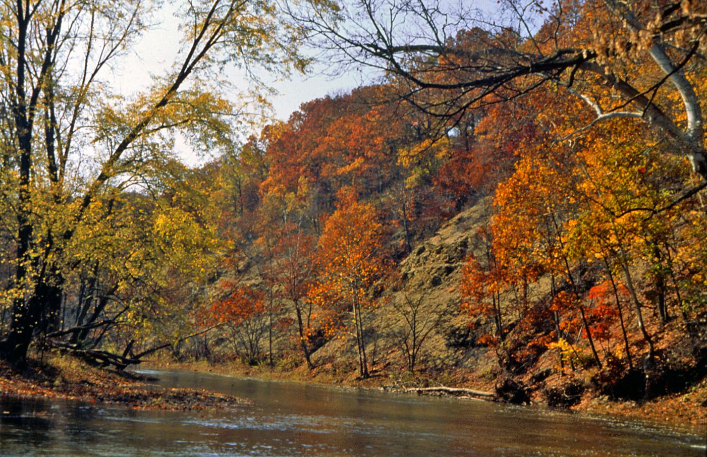
“Approximately three miles north of the city limits of Columbus and along the eastern bank of the Olentangy River is one of the least disturbed areas in Franklin County. It is known locally as Flint Ravine and High Banks.
“Flint Ravine is a deep narrow gorge cut through the ancient Devonian shale. A secondary oak and hickory forest covers the south facing slope and brink of the ravine. Beneath these trees are found squawweed, violets, golden seal, hawkweeds and many other rarities. The north facing slope is covered with dense secondary forest of beech and maple beneath which grows trilliums, hepaticas, bellworts, windflowers, blood root, wild ginger, and a host of other spring flowers in profusion. In the fall there are many varieties of asters and goldenrods.
“Extending northward for approximately 10 miles to the Delaware county line is High Banks. This interesting physiographic feature consists of an almost vertical outcrop of barren shale over 100 feet high. The level area east of the brow of this slope is covered with a beautiful forest of oak and hickory. The steep narrow ravines which have been cut into these shales are populated with vegetation similar to that of Flint Ravine. Along the flood plain great sycamores, maples, beech, and elms spread their welcome shade over the rippling waters of the Olentangy.
“Not to be ignored is the fact that one master highway borders this area on the east and another on the west.”
It should be of little surprise, then, that the fledgling Columbus and Franklin County Metropolitan Park District would seek to acquire land in this prized area. Funds became available to the new park district in 1947, and its first land purchase was a 113-acre site in the future Blacklick Woods Metro Park in March 1948. Less than a month later, Metro Parks acquired a 75-acre tranche of the future Highbanks Metro Park, a parcel of land that included an overlook of the 100-foot shale bluffs that gave High Banks its name, and also included two ancient earthworks believed to have been built by the Cole culture between 700 and 1,000 years ago. (In other areas of the park there are also two burial mounds created by the Early Woodland/Adena culture, whose cultural stamp can be seen in this area and extends for about a thousand years from around 800 BC.)
A rush of adjacent land acquisition in 1964 and 1965 provided the bulk of Highbanks Metro Park, with long years of planning ahead before park development finally began in 1972. At the end of that year, the park board of commissioners voted to dedicate a 206-acre sector of the park (including that first 75-acre acquisition) as a Scenic Nature Preserve under the Ohio Natural Areas law. Now known as the Hutchins (Highbanks) State Nature Preserve, it was named after former Metro Parks Director Edward F. Hutchins. National recognition of this area’s outstanding natural beauty was granted in March 1980, when the National Park Service designated it as a National Natural Landmark.
The park itself opened to the public in September 1973, becoming the fifth Metro Park (after Blacklick Woods, Blendon Woods, Darby Creek [later renamed Battelle Darby Creek] and Sharon Woods Metro Parks).
In the early years, there was some public disquiet about plans by Delaware County to build a sewage treatment plant directly across the Olentangy River from the Highbanks scenic overlook of the shale bluffs. The river itself had been designated as a state scenic river in 1973. After rigorous protests by the park board and other environmental interest groups, the engineering plans for the sewage treatment plant were altered so as to make the treatment plant be unobtrusive to views from the Highbanks Overlook Deck.
There seems to have been no negative environmental impact in the immediate area, to judge by the actions of the now famous Highbanks eagles. In 2010, two bald eagles established the first eagle nest in any of the Metro Parks, taking over an old raptor nest. And although that nest was damaged in a storm, the eagles moved to a new nest in a large sycamore tree, viewable from the overlook deck. They have fledged in the area every year since.
Already popular with park guests, Metro Parks added new features at Highbanks in the early 1990s, including a large wetland, new trails and the opening of the Big Meadows Picnic Area, complete with its own sledding hill. In August 1995 the Highbanks Nature Center opened and proved a huge hit with both adults and kids. It includes a library, interactive exhibits, and a large wooden deck out back, with spectacular views overlooking an adjacent ravine. The Nature Center was dedicated to former Metro Parks board member Everett Krueger. Updates to the Nature Center in the past decade include a life-size sculpted sycamore (based on one of the giant sycamores in Highbanks that form the basis for our annual Hike to the Giants programs) and a geology wall with interactive features.
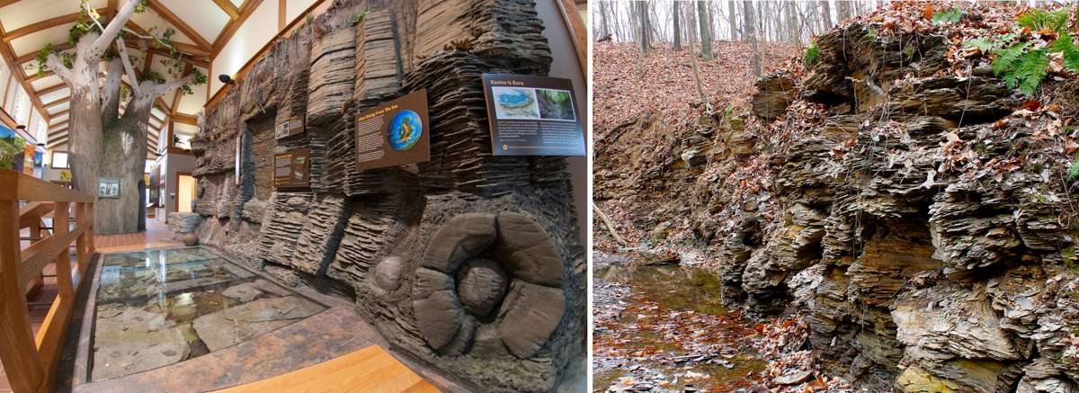
The geology wall includes an example of a concretion, many of which are found in the park. These ancient masses of compacted minerals form in sedimentary rocks, such as the shales of Highbanks, usually around a mineral deposit, such as a shell, bone fragment or plant. As such, they often contain ancient fossils. In the 1980s, one such concretion at Highbanks cracked open and revealed the fossilized jaw bone of an ancient, enormous armor-plated fish called a dinichthys. A replica of the jawbone can be seen in the nature center. See more about Highbanks concretions.
In 2014 Metro Parks acquired more land for Highbanks, a 41-acre area on the west side of the Olentangy River. This was opened to the public three years later as the River Bluff Area. It features an alternative view of the massive shale bluffs and has its own parking area and trails, plus a canoe and kayaking access point for the river. It takes the total acreage of Highbanks Metro Park to 1,203 acres.
MAP OF HIGHBANKS METRO PARK (1,203 acres)
*
WALNUT WOODS METRO PARK

In the 2009 Metro Parks Levy, the park district promised to open a new park along Walnut Creek. A 481-acre area of land had been acquired in December 2008, south of Walnut Creek, and west of Lithopolis Road, in Groveport. The area had previously belonged to Eastside Nursery, Inc, one of several tree nursery businesses in the immediate vicinity. It would become the core of the “central area” of the future Walnut Woods Metro Park (the 16th Metro Park).
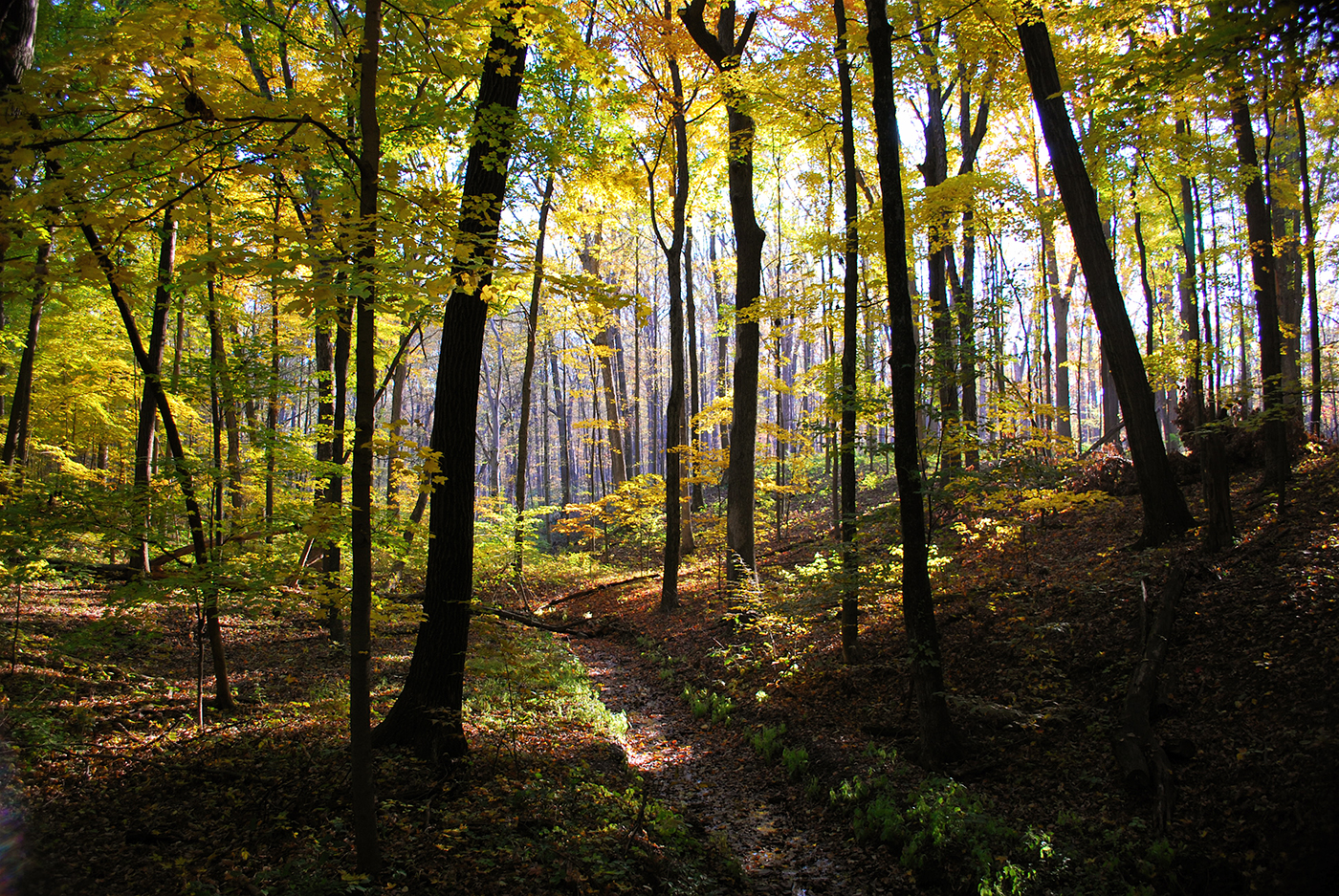
The City of Columbus had operated its own tree nursery in an adjacent area, west of Richardson Road. After years of inactivity, the pine and spruce trees in this area had become too large to be transplanted to other city parks. Metro Parks negotiated with the city and acquired the 247-acre “Tall Pines Area” from them, in a trade for a 32-acre parcel of land near to Pickerington Ponds Metro Park. The Tall Pines Area became the first section of Walnut Woods Metro Park to open to the public, in July 2011. The glorious white pines and spruce trees rise majestically either side of a narrow trail.
The area is memorialized with the name Tall Pines, but the trail, a 2.6-mile double loop, is named the Sweetgum Trail. And with perfect reason. In addition to the closely-planted pine and spruce trees, there is a large stand of beautiful sweetgum trees which turn vibrant yellow in fall. The transition on the trail from the sweetgum area to the aromatic and visually-stunning pines and spruces is recorded as magical by many park guests and team members.
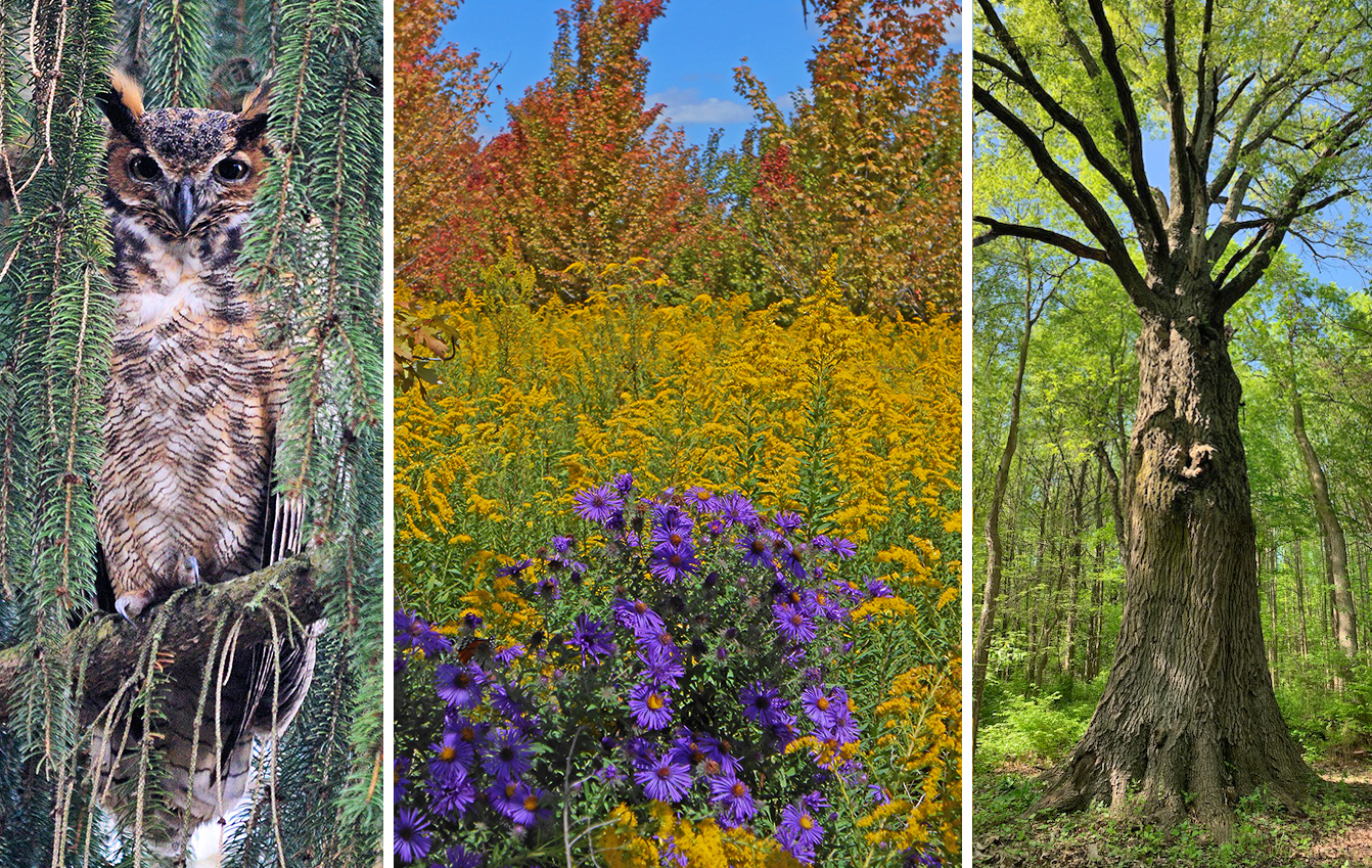
The Pin Oak Trail was built separately, a 0.4-mile trail that connects two points of the Sweetgum Trail and passes a row of oak trees, and it includes an absolute WOW 😮 moment for guests. A hollowed-out pin oak (the heartwood died but the tree itself is in fine health), more than 70 feet high and hundreds of years old, greets the guest on this short walk. It was recorded as the second largest pin oak in the entire state of Ohio. An additional 60 acres was added to the Tall Pines area in 2015, north of the original City of Columbus Tree Nursery. This additional parcel of land connects the Tall Pines Area with Walnut Creek.
The Buckeye Area, east of Lithopolis Road, opened in April 2013 and included dog parks for both small and large dogs, as well as a picnic area and an observation mound. The observation mound doubles as a small kiddie’s sledding hill in winter. A 2-mile loop trail, called the Buckeye Trail, runs along the southern bank of Walnut Creek for almost half of its length, and passes a canoe access point. Numerous buckeye trees grow alongside the creek. Part of this area was also a tree nursery in the past, and is adorned with very colorful tree species such as serviceberry, crabapple and red maple.
In the Central Area, which had also been operated as a sod farm in the past, Metro Parks removed many tons of topsoil to create three large and several smaller wetlands, which (as Metro Parks Resource Management team members had hoped) have become magnets for shorebirds and migrating waterfowl species, including sandhill cranes. The park office is located here, just west of Lithopolis Road and directly across the road from the Buckeye Area entrance.
In fall of 2013, a Boy Scout Troop built an osprey platform in the middle of the largest wetland cell (it had dried out after a hot summer), and an osprey pair arrived and began using it the following spring. The ospreys have used it every year since. A second osprey platform was built on the southern tip of this same wetland cell in December 2019.
In 2014, Metro Parks connected the Tall Pines and Buckeye Areas together by constructing the linking 1.4-mile Monarch Trail. Another trail in the Central Area, the 1.3-mile Kestrel Trail, runs through beautiful summer and autumn prairies. Both of these trails cross the narrow stream of Big Run by foot bridge.
In October 2021, Metro Parks acquired a new 282-acre plot of land adjacent to Walnut Woods. A grant from the Clean Ohio Fund Green Space will cover three-quarters of the purchase cost. The land was acquired from trustees of the Donna J. Miller Trust for Park Land. It boosts the total acreage of Walnut Woods Metro Park to 1,455 acres.
MAP OF WALNUT WOODS METRO PARK (1,455 acres)
*
As our 20 IN 22 series continues, next month we’ll take a look at Chestnut Ridge and Pickerington Ponds Metro Parks. Stay tuned and see you at Metro Parks!
Nice job on the park history articles Virginia!