VIRGINIA GORDON
Communications Coordinator
The first child gets all the love. But somehow, when the second child comes along, and even though the love of the first is undiminished, plenty of new love is always found for the second born. That is the nature of parenting. And that was the case with the nascence of Metro Parks.
Blendon Woods was the second-born Metro Park. And its proud parents, Columbus and Franklin County Metro Parks and the citizens of central Ohio, quickly showed their love for it. And why wouldn’t they. The new park was special.
In the 1945 report that proposed a Metropolitan Park System for Franklin County, the authors wrote:
“Along Big Walnut Creek, east of Westerville, cliffs of Bedford Shale (the ‘Red Hills’) are not only of scenic interest, but also include some of the wildest land in the vicinity, and provide a shelter for many unusual plants and animals.”
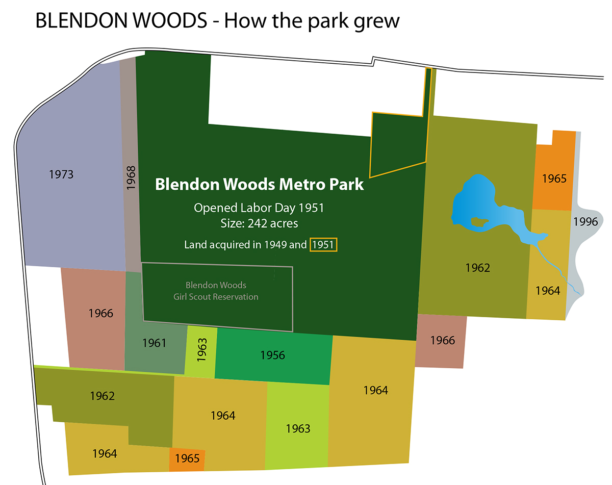
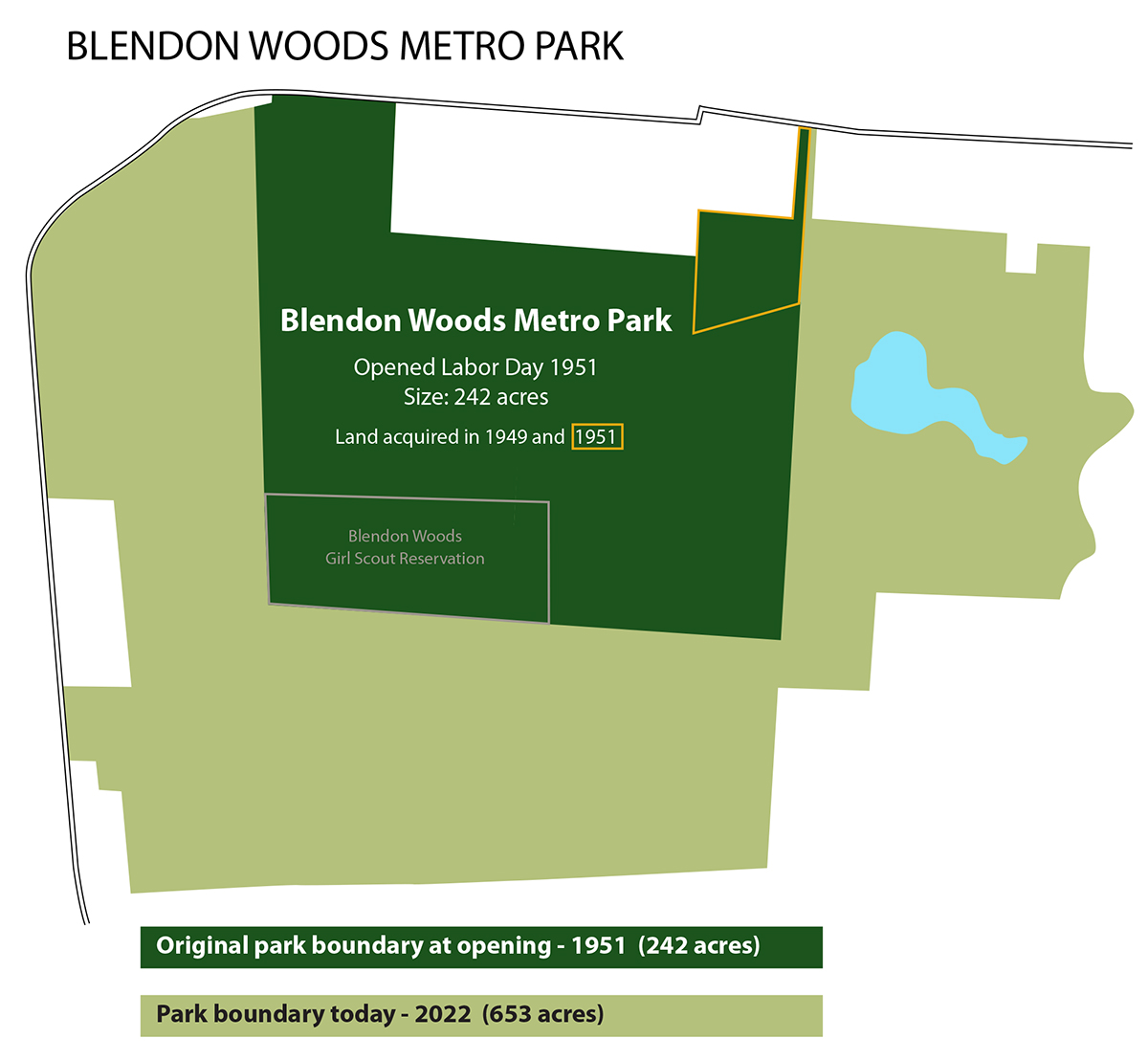 Not surprising, then, that the recently formed Columbus and Franklin County Metropolitan Park District would search that corridor for suitable park land. That search yielded a fantastic opportunity to acquire land for a rugged, wilderness-style park in Blendon Township. The first 229 acres of the future Blendon Woods Metro Park was purchased in the early months of 1949.
Heavily wooded, and sculpted by numerous high ridges and deep ravines, the land had never been suitable for agriculture and had remained largely uncleared. The woodlands comprised mature second-growth hardwood forests of oaks (mainly pin, white and red oaks), red and sugar maples, walnut and beech trees. It was largely inaccessible, and would need a commitment of time and unrelenting effort to convert it to a Metro Park.
FIRST USE
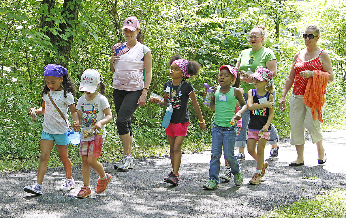
Inaccessible it may have been, but that didn’t stop public interest in using the area. Columbus and Franklin County Girl Scouts were keen to use the land for summer day camping programs, and Metro Parks was keen to host them. In June 1950, more than 100 girl scouts, ranging in age from seven to 15, attended the first of seven week-long camps held that summer at Blendon Woods. For that first season of day camp programs, the girl scouts had to arrange to use farm lanes on adjacent properties to get to the camp location, as there was as yet no public access to the undeveloped park. (Construction of the park driveway, with access from SR 161 near Cherry Bottom Road, did not begin until later that summer).
The success of the first camp season made the construction of a permanent day camp site a priority for Metro Parks in planning the future facilities of the park, which was also to include trails and picnic facilities. But the park terrain was so rugged and uneven that Metro Parks could not bring in heavy equipment to begin development of park facilities until a public access road and driveway was built. Part-funding was obtained via the state legislature to begin the work, as part of the Metropolitan Park Law.
Work began in mid-August 1950 to cut a swathe through the woods for a 16-foot-wide roadway that would extend for about a mile and a half into the park. The roadway would pass through two large woodlands and cross a number of streams and ravines. A few large trees had to be sacrificed to create the route, but wood from these sacrificed trees would be cut and used for guard rails and other construction needs at the park. More than 12,000 cubic yards of soil were moved so that Metro Parks could start grading the roadway. More than 660 feet of concrete pipes were installed for drainage, and seven culverts were built. By November 1950, the first phase of grading and drainage was complete. But better weather was needed before the next phase of roadway building could begin, and work was put on hold for the winter.
BLENDON WOODS GIRL SCOUT RESERVATION
In the summer of 1950, the girl scouts had used several large tents to protect their equipment. Now, in anticipation of the 1951 season, they came forward with a proposal to Metro Parks, that they would fund the building of a 40-foot by 25-foot rustic shelter to be used as a permanent headquarters of Girl Scouts day camping activities, and other Girl Scout activities. Metro Parks was enthused by the proposal, and decided to set aside a 40-acre area, to be known as the Blendon Woods Girl Scout Reservation. Nine camp units were created on the site, connected by trails through the woods. The shelter, partially enclosed, and with a fireplace at one end, was built in time for the 1951 camp season.
As part of an agreement with the Girl Scouts, the new shelter and day camp would be made available, after camp season, for troop camping and as a training base for adult scout leaders. [Today, this area is the site of the Hickory Grove and Sycamore reservable areas. As new land was acquired, a new location was found for the scout camp. Now called Camp Sugarbush, it can be reserved by scout troops for day or overnight camping. It is also available to organized or sponsored youth and church groups for day camping only.]
OPENING DAY
In May 1951, another parcel of 13 acres was added to the park, bordering on State Route 161. Although it included woods and a ravine, it also allowed Metro Parks to create a service entrance, which helped with development work for the planned opening of Blendon Woods that coming autumn.
But it was a rush to be ready. Labor Day, Monday September 3, 1951, was set as the official opening day for the second Metro Park. The work of adding a six-inch layer of crushed stone on the previously graded roadway was only completed by the State Highway Department on Thursday August 30. The road was solid and stable, but dusty. The addition of a bituminous surface had to wait until the following year. Park workers began preparing picnic sites on the Friday, and added picnic tables and stoves over the rest of the weekend. The effort was rewarded by a great turnout of visitors as the second Metro Park became a reality for the people of central Ohio.
WINTER WOES ARE OVERCOME
A bad winter contributed to softening of the as yet unfinished roadway, so much so that at times the road had to be closed. But visitors still came, often parking on State Route 161 and walking to park facilities. Trails were developed to go through the woods and across ravines, and trees were planted in the picnic areas and adjacent to parking lots.
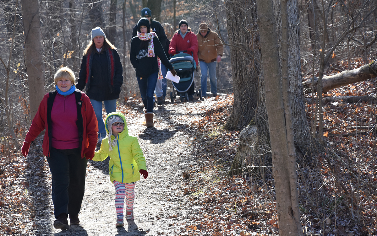
Guided Sunday afternoon nature walks were instituted in April 1952. A new 2-mile loop trail went deep into the woods and through some of the ravines, passing exposed rock faces and making geology a focus of the weekly hikes, led by a park naturalist. Spring Wildflower Walks and Spring Migrating Bird Walks began a couple of years later.
OVERCROWDING
The need for a second Metro Park had become obvious very quickly. The first Metro Park, Blacklick Woods in Reynoldsburg, which had opened in October 1948, had proven so popular that it couldn’t cope with the crowds. In the summer months, family picnicking was the primary draw bringing visitors to the park. But parking and picnicking facilities at the then 113-acre Blacklick Woods were inadequate for the demand.
It was hoped that the addition of Blendon Woods and its own picnic facilities would spread out the demand for family and group picnics, but it actually stimulated and increased the demand. Large groups became a particular problem, as it was seen that they were taking over park areas for picnics and outings. Often, picnic tables would be removed from smaller picnic areas, leaving no tables available for family picnickers. In an effort to satisfy demand, Metro Parks set aside certain facilities for larger group use, and required any group of 25 people or more to obtain a permit and reserve the group shelter in advance. At the same time, picnic tables were anchored in place, so that picnic tables they could no longer be removed from smaller picnic areas by large groups, which had begun to happen to the detriment of family picnickers. The new system, after a few growing pains, worked well for churches, clubs and school groups, but by 1955, an upper limit of 200 people was imposed for any one gathering, as facilities continued to be stretched beyond capacity.
EXPANSION OF BLENDON WOODS
The need for more land, more parks, more facilities, was clear enough, but Metro Parks didn’t have the funds for major expansion. Levy requests went to the voters in 1949 and 1951, but both times the levy failed.
Then in November 1960, Franklin County voters passed a 0.3-mill Metro Parks Levy. This, the first Metro Parks Levy to pass, allowed Metro Parks to tackle the overcrowding issues that were actually beginning to damage both natural habitat and created structures at the parks. (Darby Creek Metro Park, at 111 acres about the same size as Blacklick Woods at the time, had opened in September 1959).
A small expansion had been made at Blendon Woods in 1956, when a 22-acre wooded area, with a few meadows, had been added. Initially, it was used by the Camp Fire Girls, extending their day-camping program at the other Metro Park, Blacklick Woods. In September 1959, a third park opened, Darby Creek Metro Park. At 111 acres, it was about the same size as Blacklick Woods. That same year, 1959, more than 190,000 people visited the now 264-acre Blendon Woods.
Levy funds allowed for a decade of expansion at Blendon Woods. From 264 acres at the start of the decade, the park had grown to 577 acres by January 1968. A further and final two additions to the park came in May 1973, with an acquisition in the northwest sector of the park, and a small conservation easement at the eastern boundary of the park in 1996.
NEW RESERVABLE PICNIC AREAS (AND A RELOCATED DAY CAMP)
In 1959, Blendon Woods opened the Shadblow Reservable Picnic Area. It proved so successful that one of the first projects to be completed after the 1960 Levy was the creation of a second such reservable area, the Dogwood Reservable Picnic Area.
The acquisition of land bordering on Cherry Bottom Road gave Metro Parks planners a chance to rethink the day camp area. By moving the Day Camp Area, it would be possible to give the day camp its own entrance on Cherry Bottom Road, and to restrict access to the camp from other areas of the park. After consultation with numerous scout and camping groups, the Sugarbush Day Camp was created. At 45 acres, it was slightly larger than the original Girl Scouts Reservation. It is still in use today, as both a day camp or overnight camp facility for scouts. It can also be reserved by other organized youth groups, but for day camping only.
The original day camp area, adjacent to the Dogwood Reservable Picnic Area, was eventually used to expand reservable picnic facilities at Blendon Woods. The Sycamore Reservable Picnic Area and Hickory Grove Reservable Picnic Area were built in this area.
THE TRIUMPHS AND TRAVAIL OF THOREAU LAKE
Water supply to the park had always been poor. There was no city water supply. Five deep wells were drilled, one of them 100 feet deep. Installation of a new type of hand pump and sanitary drinking fountains allowed visitors to obtain drinking water. But the park was so heavily used that four of the wells would often be pumped dry during the busy times, especially during summer and at the weekly hikes. Picnickers often complained about the lack of water at picnic sites.
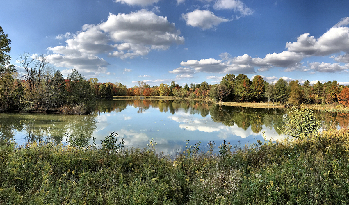
With the acquisition of new land, Metro Parks planners came up with the idea of using surface water as a temporary additional water supply for the park. In 1964, the US Soil and Conservation Service provided engineering service to help Metro Parks build a lake in an area east of the original park boundary. The lake, along with the installation of a new water system and about a mile of piping, alleviated some of the park’s water supply problem. That problem itself was fixed eventually, when the northward expansion of Columbus allowed Columbus water lines to be extended to the park sooner than expected.
The lake was no longer needed as a park water supply, but it led planners to develop the idea of creating a wildlife refuge in this area of the park.
THE THOREAU LEGACY
In the late 1950s, national news had been made when a wilderness preserved by 19th century naturalist, Henry David Thoreau, around Walden Pond in Massachusetts, was partly destroyed by the state’s county commissioners. The wilderness had been deeded to the state with the provision that it be kept in a natural state. But the county commissioners, determined to provide recreational services, destroyed trees and built hard-top roads to the lake, to be used for bathing and other recreation. The Boston Globe called it the “popular disfigurement of a cultural shrine.” The fight to preserve Thoreau’s legacy went to court and would go on for many years. Eventually it yielded some success.
In Ohio, Metro Parks chose to honor the legacy of Thoreau, one of the great American naturalists, by naming their new 118-acre refuge as the Walden Wildlife Refuge, and by naming the 11-acre lake at its core as Thoreau Pond. In time, these names were changed to the Walden Waterfowl Refuge, and to Thoreau Lake.
THE REFUGE
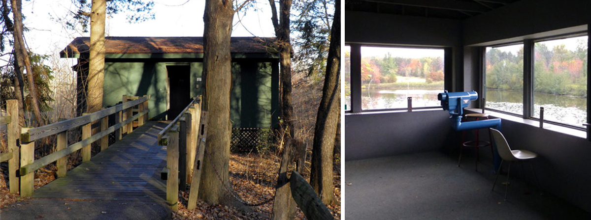
In autumn 1968, two elevated observation shelters with viewing blinds were built close to the lake. The shelters sported spotting scopes, which afforded really close-up views of the waterfowl using the lake, without disturbing the wildlife. To further protect the wildlife from being spooked, a chain link fence was erected around the entire refuge. An all-weather path, a third-of-a-mile long, shielded by pines and shrubs, allowed easy access to the lake from the parking lot, where a nature interpretation center was opened in 1969. This was the forerunner of the larger Blendon Woods Nature Center, which would open in 1976.
In an effort to attract greater numbers of waterfowl, Metro Parks consulted with waterfowl biologists and a feeding program was started. A gravel bar was constructed on which animals could feed, and a diet of cracked corn and shelled corn was provided, to help attract flocks and keep a large number of birds at the lake during typical park visiting hours. To attract bay, sea and diving ducks, the lake was also stocked with gizzard shad.
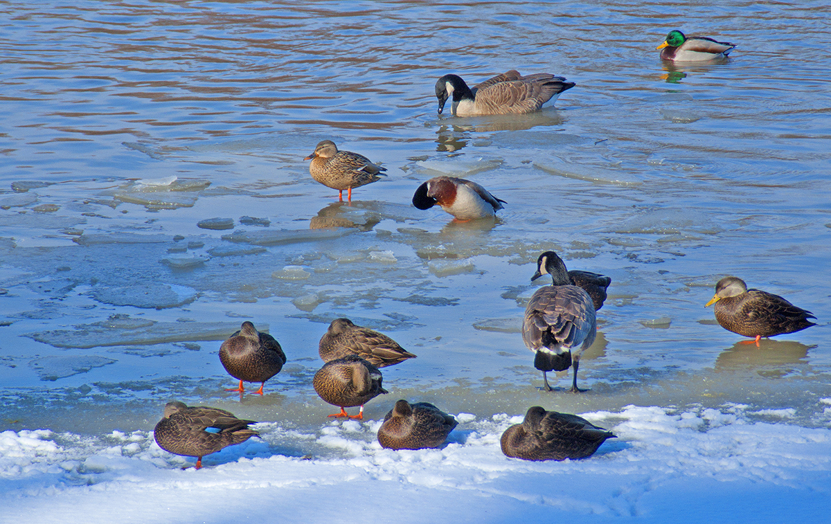
Planners recognized a need to keep open water throughout the winter and an aeration system was installed. Many bodies of water of this size could freeze over during an Ohio winter. A part of Thoreau Lake was guaranteed to stay open during even the coldest winter by the effects of the aeration system. It moved warm water up from the bottom of the lake and kept a 3,000 square foot area of water from freezing. Migrating birds ignored frozen areas of the lake and continued to visit. The aerated area was closest to the observation shelters.
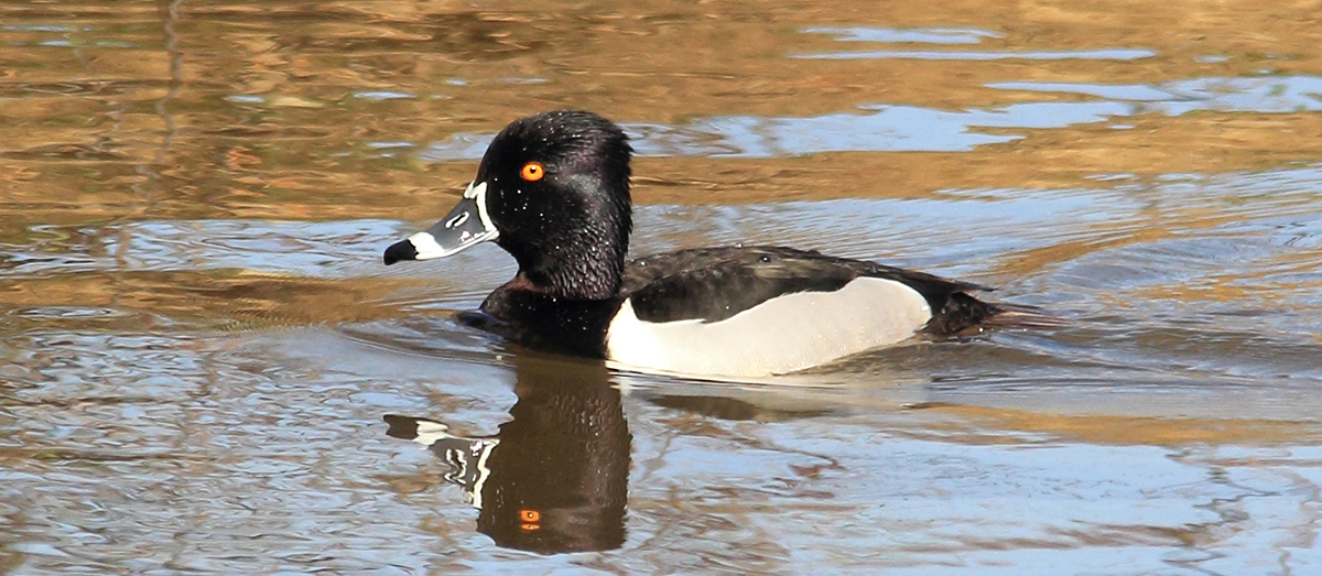
The refuge was a great success with both waterfowl and humans. Some rare species seen during the early years included loons, cormorants and snow geese. More than 50,000 people would use the shelters during the winter season, covertly witnessing the to and fro as wood ducks, mallards, teal, mergansers and buffleheads joined dozens of other species in resting or feeding at the lake. Often there would be more than 1,000 birds at a time seen on the lake during the winter months. And then… disaster struck!
A FLOOD OF TOXIC WASTE
In February 1984, park rangers discovered more than 1,800 dead fish in the lake. There was a suspicion that the fish may have been killed by a combination of pollution by heavy metals and ammonia. Analysis confirmed this to be true. Testing found traces of heavy metals, copper, lead, zinc and nickel in the lake sediments. Investigation traced the source of the pollution to a manufacturing company just outside the boundary of the park, which had negligently discharged industrial waste, as well as inadequately treated human sewage, into a small stream bed that fed into Thoreau Lake. The tributary, which flowed from the manufacturer’s business, had been marked previously by the Ohio EPA as turning blue-green in parts, a sign of high copper content. Tests by the EPA had also shown the stream to contain ammonia compounds.
In mid-September 1984 the Ohio EPA ordered the electroplating company, Harrison Enterprises, to stop discharging metals into the stream and to pay for restoration work on the polluted stream and lake. Just nine days later, Harrison Enterprises’ plant was destroyed by fire and the bankrupted company closed down. Metro Parks was left to cover the clean-up cost for Thoreau Lake, which amounted to more than $140,000. It emerged that Harrison Enterprises had received notices from the EPA over many years, regarding public complaints about illegal discharge of toxic waste. They had been polluting the environment for years, and yet no significant action had been taken against them.
On the advice of the Ohio EPA, Metro Parks completely drained the 11-acre lake. Using bulldozers, earth movers and a huge drag line, the silt layer of the polluted lake bottom was dragged away to a nearby field, where it was mixed with soil over a 2-acre acre, to reduce the concentration of polluted sediments.
THE REOPENING
The Walden Waterfowl Refuge was reopened on July 1, 1985. That November, record rainfall of 12.45 inches helped to fill the lake to overflowing. The overflow flows into a stream that crosses the entire width of Blendon Woods and joins with Big Walnut Creek in the west. The lake is at its deepest near the overflow, at a depth of 13 feet. At its reopening, Thoreau Lake now had a new mud flat and a small mud bar for additional shorebird habitat. A second aeration system was installed that summer too. Winter migrants returned in the usual high numbers and the refuge has retained its status as one of central Ohio’s premier winter migration spots for waterfowl. The Refuge has been designated by the state as one of its 80 Watchable Wildlife Areas, and by Audubon Ohio as an IBA, or Important Bird Area. More than 230 bird species have been recorded here.
OTHER FEATURES OF THE PARK
The Sugarbush and Goldenrod Trails were added in the 1980s. The 2-mile Sugarbush Trail goes through the woods and is reserved for Cross-Country Skiing when snow conditions permit. The 1.3-mile grass-surface Goldenrod Trail is the park’s one designated pet trail, although leashed pets are also allowed in picnic areas, parking lots and on roadways. In total, the park now features 5.7 miles of trails.
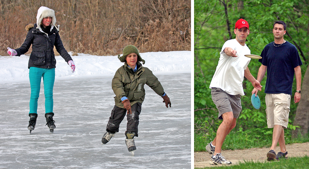
In 1985, the Disc Golf Course opened in the far northwest of the park. With 18 holes, and at more than 3,700 feet in length, the course is free to use, but players must bring their own discs. A little way south of the disc golf course, a 0.4-acre pond, only 18 to 24 inches deep, freezes over in winter and is ideal for ice skating when conditions permit.
In 2011, a 10-acre Natural Play Area was opened. It is dissected by a stream and ravine, and features a wooded hillside where kids can climb trees and enjoy unstructured play. In 2017, thanks to donations from Michelle and Maris Zugaro and REI, numerous great play features were added to the natural play area, to help celebrate the wild child in all of us. The play features include a zip line, teeter-totter, basket swing, cargo climbing net, a tether-ball game and various stepped logs over ravines and streams. Read Michelle and Maris Zugaro’s poignant story behind their donation
Loving memories inspire great new features at Blendon Woods for the Wild Child in all of us
PICNICKING TODAY
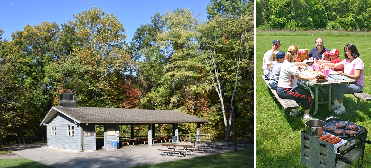
In addition to the four reservable shelters (Sycamore has a capacity of 130 people, Dogwood and Hickory Grove each have a capacity of 110 people, and Shadblow has a capacity of 50 people), there are seven shelters available free on a first-come first-served basis. They all have grills. Five of them are enclosed on three sides and can each seat approximately thirty people. The other two are open shelters that seat about 80 people.
THE BUTTERFLIES OF BLENDON WOODS
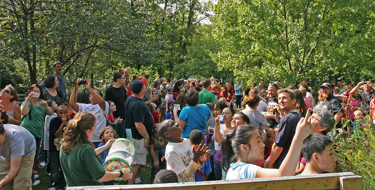
Blendon Woods became known as the park for monarchs. In June, for many years, the Monarch Mansion was set up outside the park’s nature center. The Monarch Mansion was a tent dedicated to the healthy raising of monarch butterflies, ahead of their amazing 2,000-mile fall migration to Mexico. Monarch caterpillars were fed on milkweed plants growing in the mansion. (The park also fed other monarch caterpillars in the nature center). Visitors were welcome to the mansion at any time to watch their progress, as the caterpillars girded themselves by gorging on the milkweed. They then went through a pupa phase, forming a chrasylis before transforming into the beautiful monarch butterfly. And then, during the first weekend of September, the park hosted its Monarch Weekends, at which the monarchs raised at the park were released for their big migration to the oyamel fir tree forests of Mexico, their traditional hibernation grounds. In recent years, the focus has changed to a celebration of all our native butterfly species. The Monarch Mansion has become the Butterfly House, and the Monarch Weekends are now Butterfly Weekends.
Thoreau Lake can be excellent waterfowl and animal habitat, but iover the last summer it became so plant choked it was eutrophic to the pointthat few aquatic birds or animals could be seen. Are there plans to on again drain and restore the open waters?
Timothy,
Thoreau Lake has some natural and unnatural challenges. The aquatic succession that you observe is expected; lakes like ours that have been created by damming a stream usually fill with sediment, becoming shallower in the process. The excess of aquatic vegetation (in our lake, both native and non-native), and heavy sediment load from changing land use up stream (Hamilton Road area) has sped the process in Thoreau Lake. No doubt we experience an unnatural nutrient load from the runoff as well. This is true unfortunately for most waterways in Ohio.
The real challenge for us from a maintenance standpoint is 1. The financial and ecological cost of draining the lake. And more importantly 2. The lake experienced a heavy metal spill in the 80s. It was remediated (as described in the article), but there is a danger that the bottom sediments may still contain contaminants. Therefore dredging or even mechanical removal of plants from the bottom could potentially stir up another incident not only in our pond, but also downstream in Big Walnut Creek and beyond. We are currently undertaking the necessary steps to determine if dredging will ever be possible. The answer might be “no”, and then we will have to decide how to proceed.
We do not have any definitive answers for this issue yet, and it is important that we do not rush into action without considering all of the consequences of our choices. Like most places in Ohio, alteration of the natural landscape by humans has created the necessity for fairly intensive management of habitats. We take this responsibility seriously, and want to do what is best for all of the ecosystem inhabitants, not only at Blendon Woods, but everywhere that is affected by what we choose to do at the park.
Thank you for sharing the history and evolution of Blendon Woods Metro Park. This park is near many neighborhoods and to my knowledge has no walkable access to the park. As a new Greenway is being developed along Big Walnut Creek, and a multiuse path and crosswalk has been developed on Cherry Bottom Rd, are there any plans for multiuse path or safe pedestrian access to to the park?