VIRGINIA GORDON
Communications Coordinator
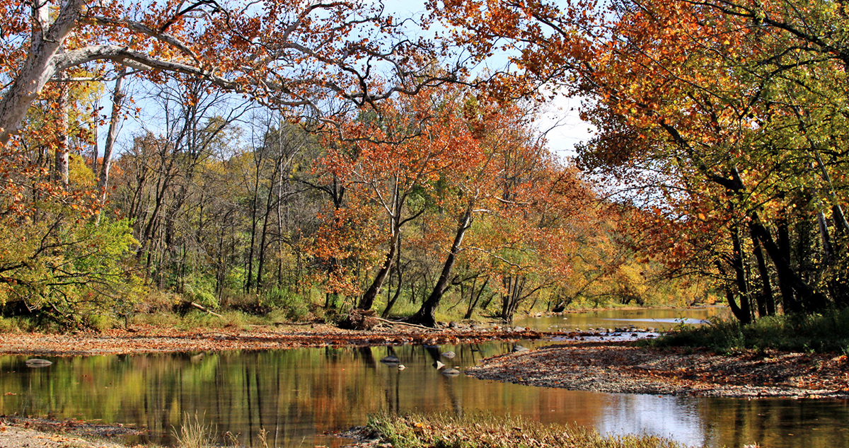
Ole! It’s worth celebrating. Just more than 50 years ago now, the Olentangy River became only the third Ohio waterway to be honored with the designation as a state scenic river. A 22-mile section of the Olentangy was adopted as a Scenic River by the Ohio Department of Natural Resources’s (ODNR’s) Division of Natural Areas and Preserves on August 24, 1973. The entire 22-mile stretch starts just below the Delaware Dam and flows downstream to Worthington. [Previous designations as State Scenic Rivers were accorded to sections of The Little Miami River in 1969 and 1971, and to a section of the Sandusky River in January 1970.]
It’s no coincidence that the designation of the Olentangy as a Scenic River occurred in August 1973, which is the same month that Highbanks Metro Park opened. Three miles of the Scenic River flows along the western edge of Highbanks Metro Park. The designation doesn’t simply identify a pretty stretch of waterway, it actually makes a commitment that this stretch of water is worthy of preservation and protection from developers. Metro Parks had been acquiring and protecting land at the future Highbanks since 1949.
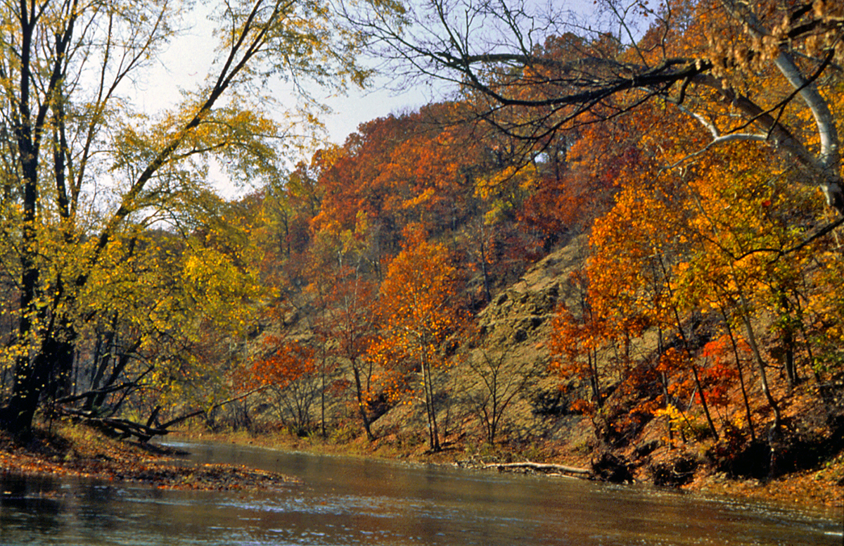
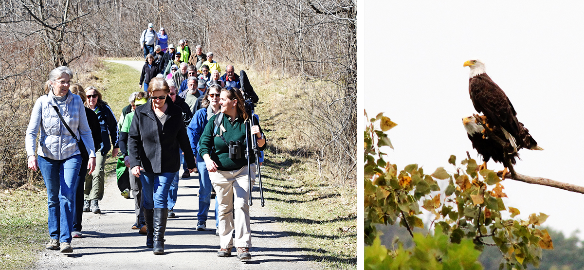
Perhaps no part of the river is more scenic than the high shale bluffs at Highbanks. Black Ohio Shale bluffs rise commandingly 110 feet above the river. From the top, the bluffs form a perfect overlook of the river. Metro Parks has built an observation deck so visitors can enjoy the view. In earlier times —we believe between 800 and 1,200 years ago— Native Americans from the Cole Culture built a 1,500-foot horseshoe-shaped earthwork at just about the same spot. You can see the earthwork near the end of the 2.3-mile Overlook Trail, which takes you to the observation deck. The deck sits within a 206-acre state nature preserve, also so-designated by the ODNR Division of Natural Areas and Preserves. It is named as the Hutchins State Nature Preserve, and honors Ed Hutchins, who served as Metro Parks’ Director for more than 20 years.
THE EAGLES HAVE LANDED
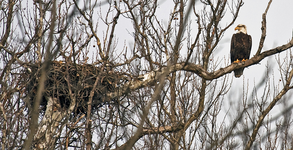
As well as providing great views of the river, the observation deck also affords excellent views of the eagle nest. The now-famous Highbanks eagles built their first nest here and fledged their first baby in April 2010. Although that first nest was later damaged in a storm, the eagles built a new one close by and have returned every year since. Great views of the high walls of shale can be seen from the opposite side of the river, in the River Bluff Area. Metro Parks opened this relatively recent addition to Highbanks in 2017. Great closeup views of the Olentangy can be enjoyed by walking the area’s Sycamore Trail, which runs alongside the river for part of its length. The Scenic River Trail, in the northern section of the park, also runs alongside the river.
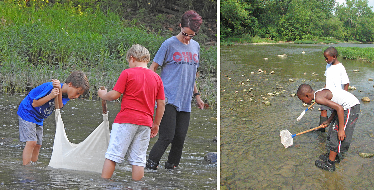
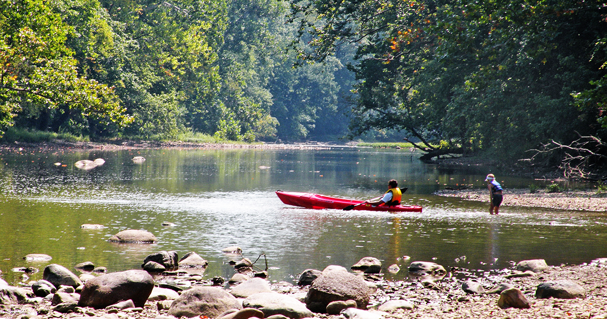
The river is fairly shallow, which makes it easy for wading anglers. Highbanks features numerous access points on the river for fishing, and there are lots of bass, bluegills and hognose suckers to catch. Highbanks also offers canoe and kayak access or take-out points on the Olentangy in the Big Meadows Area and in the River Bluff Area. Visitors can enjoy solitude and tranquility on a float through Highbanks and get the closest views available of the high shale bluffs that give the park its name. There are many other canoe and kayak access points on the river, both north and south of Highbanks.
WATER TRAILS AND GREENWAYS
Way south of the park, The Olentangy River Water Trail is a great feature for canoeists and kayakers. The first 3 miles of the water trail starts at Broadmeadows Bridge, just south of Antrim Park and the Broadmeadows Dam. It provides uninterrupted paddling and takes the floater through Kenney Park and Nature Preserve and through Whetstone Park. The next 2.5-mile section of the water trail includes three low-head dams, and floaters will have to portage their canoe or kayak to bypass these hazards. The last section of the water trail again includes uninterrupted paddling and passes by Ohio Stadium and enters the city of Columbus. The water trail ends at the Lower Olentangy Boat Launch, just before the great tributary joins with the Scioto River.
If you’d rather bike, hike, jog or roller-blade alongside the banks of the Olentangy, you can do that on the Olentangy Greenway Trail. This very popular trail starts at the junction with the Scioto Greenway Trail in downtown Columbus, and extends 13.5 miles northwards to Worthington Hills Park, just south of Highbanks. It means you have so many easily accessible ways to interact with this wonderful river.

MEIN NAMEN IST…???
The full course of the Olentangy runs for 97 miles, from its source southeast of Galion, in Morrow County, all the way to the Arena District in the City of Columbus, where it flows into the Scioto River. Over to the west, Big Darby Creek also flows north to south and eventually joins with the Scioto River. These two waterways have an identity problem, but let’s not tell them that, eh? You see, back in the 1700s, what we now know as Big Darby Creek was actually called the “Ollentangy” (sic) by the local Wyandot Indians. The name means “river of red face paint,” and refers to the red oxide clay found at the source of the river. The Wyandots used this red oxide clay to make their war paint. At about this same time, what we now call the Olentangy was in fact named the Whetstone River. This was basically a translation of a Native American name for the river, “Kiin ansh ikan Siipu nk,” which meant “sharp and more sharp tools river.” It refers to the black Ohio shale found in the river, which both native Americans and early frontier settlers used to sharpen their tools and weapons. In other words, they used the shale as a ‘whetstone.’
In the late 1700s, surveyors of the area renamed the original “Ollentangy” as Big Darby Creek, based on the anglicized name of a Native American chief who lived near the mouth of the stream. In 1833, the Ohio Legislature introduced an act seeking to restore Native American names to several state waterways. As “Kiin ansh ikan Siipu nk” was considered a bit of a mouthful for anyone to pronounce, the Legislature went with the now unused “Olentangy” as the name for the then Whetstone River. And that’s how we have the Olentangy River instead of the Whetstone River today, but still with various references back to its former name, in the shape of Whetstone Park, which borders the river, and Whetstone High School, both in Clintonville.
I’ve lived close to the Olentangy River for 5 decades and love to walk down there and just hang out for an afternoon. It’s a soothing getaway from being in the heart of the city.