Measuring the depths of our lakes and ponds
ANDREW BOOSE
Aquatic Ecologist
If you have on any sort of park uniform and are standing next to one of the 60 Metro Parks ponds or lakes, someone will inevitably ask, “Hey Ranger, how deep is that pond?” One may be able to reasonably answer the query if they had a historical construction knowledge of the body of water, or one could just use a SWAG, aka a “scientific wild-ass guess.”
But before we answer the question, we should consider the word “deep.” If I am standing next to Kareem Abdul Jabbar in 6 feet of water, we are going to have a very different idea of the definition of how deep the water is. My personal definition of deep is water you cannot stand in and keep your head above. Though the temperature of the water also has a lot to do with how deep is deep.
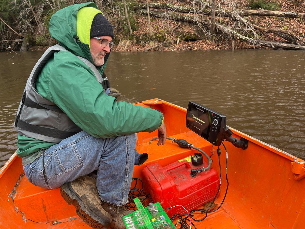
Well, technology comes to the rescue. Metro Parks has recently purchased a Humminbird© Sonar (sound navigation and ranging) unit equipped with the ability to chart ponds and lakes in a relatively short period of time. Killdeer Pond (1.1 acres) at Metro Parks Headquarters, behind the OPRA building, took about 30 minutes. The three lakes at Prairie Oaks (total of 78 acres) took about five hours to complete. The sonar reads the topography of the floor of a water body. Learning the topography will help with management decisions, stocking considerations, as well as understanding the health of the lakes and ponds.
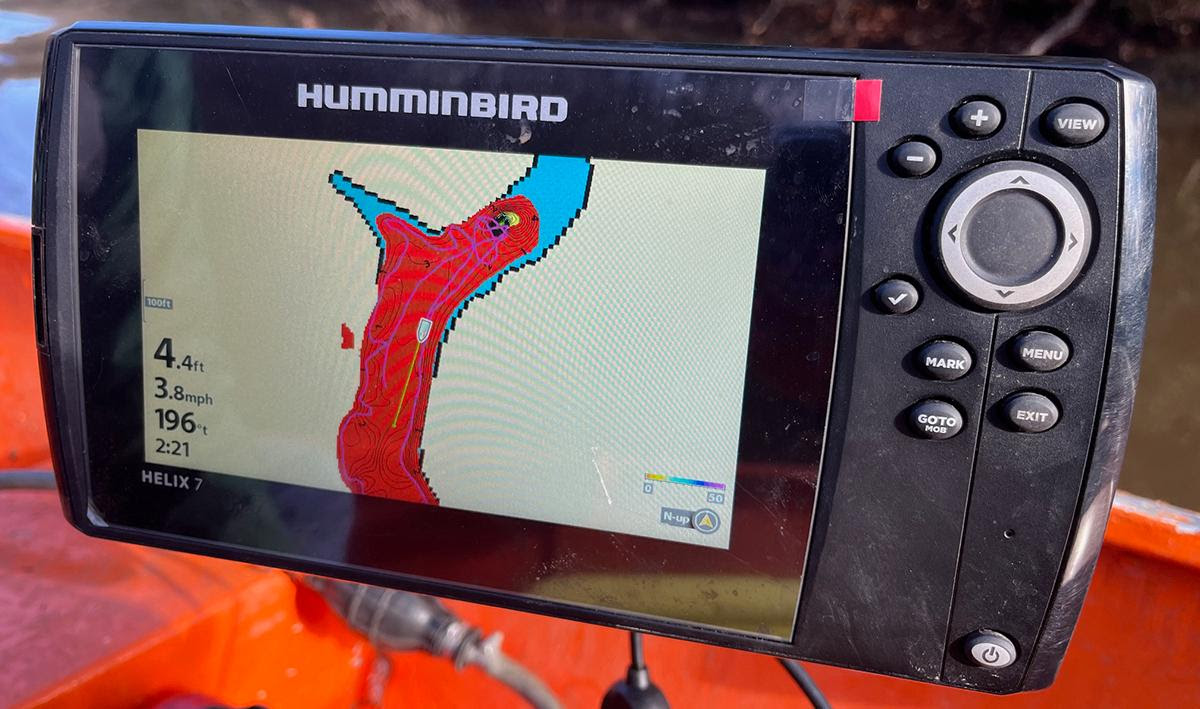
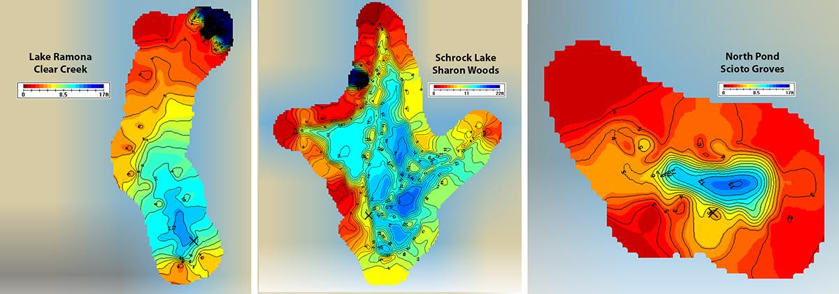
The maps the SONAR program creates are nicely colored, showing contours and depths. So far 20 lakes and ponds have been sounded and maps posted to Metro Parks’s Google Drive for park managers to see. If you are looking for lost fishing gear or that wrench you let slip last spring, you will need to put a lot more money into a far more precise unit. While the maps we are getting from our unit are nice, they are relegated to a minimum of 1-foot intervals. One goal of this program is to post maps at the lakes and ponds for the public to see. Keep in touch with the Resource Management Crew to see if a pond or lake you are interested in seeing will be the next to be sounded.
Is it possible for a fisherman to get a copy of Pairie Oaks lakes ? Thanks